Evolution and Ecology of Invasive Plant Species
Effects of Large-Scale Disturbances on the Proliferation and Spread of Phragmites australis
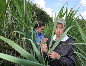
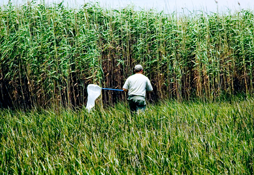
Project Description
Biological invasions impose considerable threats to the world’s biodiversity and incur substantial economic losses. In the U.S., non-native species have caused environmental damage and losses adding up to almost $120 billion per year (Pimentel et al. 2005). Also, 42% of the species on the threatened or endangered lists are at risk of extinction primarily because of invasive species. It is therefore imperative that we monitor and understand the factors influencing the proliferation and spread of these species.
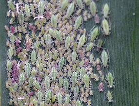
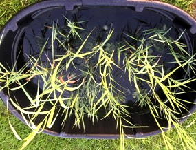
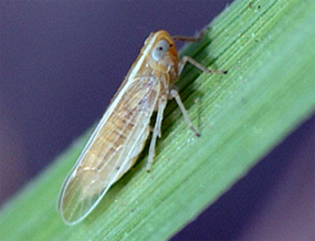
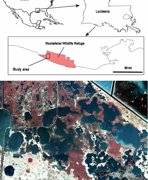
Historically, the wetland grass species Phragmites australis (common reed; Fig. 1) was uncommon in North American marshes. However, in the past century it has exhibited prodigious rates of expansion, most notably along the Atlantic Coast. The rapid spread of P. australis has been attributed to a Eurasian genotype that likely arrived in the U.S. in the mid to late 1800s and has rapidly spread across the continent. In Louisiana, several Eurasian genotypes have been discovered in the Mississippi River Delta and have become widespread in the region (Lambertini et al 2012). At one of our study sites, Rockefeller Refuge, a European genotype of P. australis is quite common (Fig. 2). Louisiana is a hotspot for P. australis genetic diversity. In addition to several Eurasian genotypes, there is another common genotype known as the Gulf Coast genotype.The status of the Gulf Coast genotype is unclear, but it is primarily distributed in Central and South America and may represent a natural invasion into the U.S. It is found in all of the Gulf Coast states and has spread westward to California.
Eurasion invasive genotypes of P. australis pose serious risks to the rare native populations of P. australis. They are also known to have a substantial impact on marsh ecosystem structure and function by affecting nutrient cycles and hydrological regimes, displacing native plant species, and reducing the quality of wetland habitat for migratory waterfowl and wading bird species, and a variety of other species. Nonetheless, direct economic damage has not been adequately assessed, particularly along the Gulf Coast.
For the Gulf and Atlantic Coasts of the United States, extreme disturbance events (i.e., tropical storms and hurricanes) are common and are predicted to increase in magnitude and frequency as a result of global climate change (Fig. 3). My former PhD student, Ganesh Bhattarai, and I hypothesized that these large-scale disturbance events may affect the growth and spread of invasive P. australis. Several lines of evidence suggested that P. australis may actually benefit from hurricanes. First, Chabreck and Palmisano (1973) suggested that P. australis is amonst the first wetland plants to recover from hurricane damage. Second, after hurricanes Katrina and Rita hit Louisiana in 2005, we observed obviously displaced clumps of P. australis with new shoots in roadside ditches, cattle pastures, and residential areas kilometers away from any source populations.
Research program
Mapping the distribution and monitoring the spatial spread of P. australis has become feasible and practical at large spatial scales owing to the development of remote sensing methodologies. Initial efforts to accurately map P. australis spatial distributions using aerial photographic or satellite imagery have been plagued by 1) difficulties in distinguishing P. australis from other common wetland species, and 2) limited spatial resolution. An alternative method, which we developed for P. australis (Rosso et al. 2008), comprised the use of lidar and multispectral imagery to identify P. australis. Lidar uses pulses of laser light emitted from a low-flying aircraft to obtain terrain heights, often with sub-meter precision. P. australis spectral signature and its unique feature of being so tall (3-4 m) can be used to distinguish it from all other marsh grasses. In Louisiana, aerial photographic images are available dating back to the 1930s, prior to the appearance of invasive P. australis in the Gulf Coast (Stanton 2005).
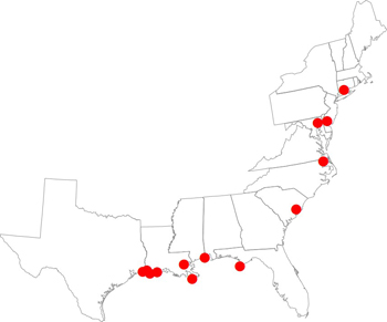
Ganesh Bhattarai and I compiled historical and present-day distributional maps of P. australis from 13 marshes along the Atlantic and Gulf Coasts (Fig. 4). These were relatively undisturbed wetlands where P. australis had room for unrestricted growth.
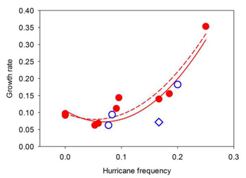
As part of his dissertation research, Ganesh used historical aerial images (spanning 5–27 years) to determine the growth rate of P. australis patches within each of these marsh sites (9 inhabited by the Eurasian and 4 inhabited by the Gulf-Coast haplotype). For each site, he estimated wind speeds of all storms, counting only those that qualified as a tropical or subtropical storm (maximum sustained wind speeds of 65–119 km/h) or hurricane (>=119 km/h). By dividing storms into these two wind-speed categories, we were able to test the a priori prediction that growth rates of P. australis patches were more strongly related to the frequency of more intense storms.
We found that over the past several decades, invasive P. australis stands expanded in size by 6–35% per year (Bhattarai and Cronin 2014). Based on tropical storm and hurricane activity over that same time period, we found that the frequency of hurricane-force winds explained 81% of the variation in P. australis growth over this broad geographic range (Fig. 5). The expansion of P. australis stands was strongly and positively correlated with hurricane frequency. In light of the many climatic models that predict an increase in the frequency and intensity of hurricanes over the next century, these results suggest a strong link between climate change and species invasion and a challenging future ahead for the management of invasive species.
References
- Lambertini, C., I. A. Mendelssohn, M. H. G. Gustafsson, B. Olesen, T. Riis, B. K. Sorrell, and H. Brix. 2012. Tracing the origin of Gulf Coast Phragmites (Poaceae): a story of long-distance dispersal and hybridization. American Journal of Botany 99:538-551.
- Pimentel, D., R. Zuniga, and D. Morrison. 2005. Update on the environmental and economic costs associated with alien-invasive species in the United States. Ecological Economics 52:273-288.
- Rosso, P. H., J. T. Cronin & R. D. Stevens. 2008. Remote Sensing for Environmental Monitoring, GIS Applications and Geology. Michel, U., D. L. Civco, M. Ehlers and H. J. Kaufmann, Eds. The International Society of Optical Engineering, Bellingham, WA.
- Stanton, L. E. 2005. The establishment, expansion and ecosystem effects of Phragmites australis, an invasive species in coastal Louisiana. Louisiana State University, Baton Rouge, Louisiana.